What image formats do you accept?
We accept JPEG, PNG, TIFF, and WebP. For large field datasets we also support batch upload via cloud storage (S3, Google Cloud Storage) or our on-premise NAS pipeline. If you have a specific format or delivery method, just let us know and we will accommodate it.
How long does polygon annotation take?
Standard polygon annotation projects (up to ~1,000 images with 5–15 objects per image) are typically delivered within 24–48 hours. Larger batches or projects with complex per-image density are scoped individually. We will give you a project schedule before work begins so there are no surprises.
What export formats do you support?
We deliver in COCO JSON, Pascal VOC XML, and YOLO TXT — the three formats compatible with all major computer vision training frameworks. Custom schemas (e.g. proprietary CSV, project-specific XML) are available on request at no additional cost for existing clients.
Do you work with clients outside India?
Yes. The majority of our clients are based in Europe and North America. Our parent company H2L Robotics BV is Dutch, and we regularly work with agricultural robotics teams in the Netherlands, Germany, and the US. Dataset delivery is fully remote — we receive images via cloud storage and return annotated exports the same way.
What crops and agricultural subjects do you annotate?
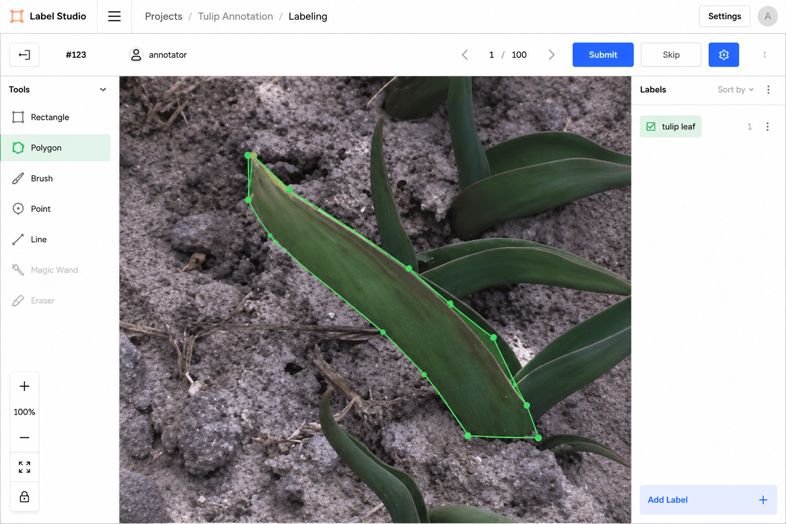
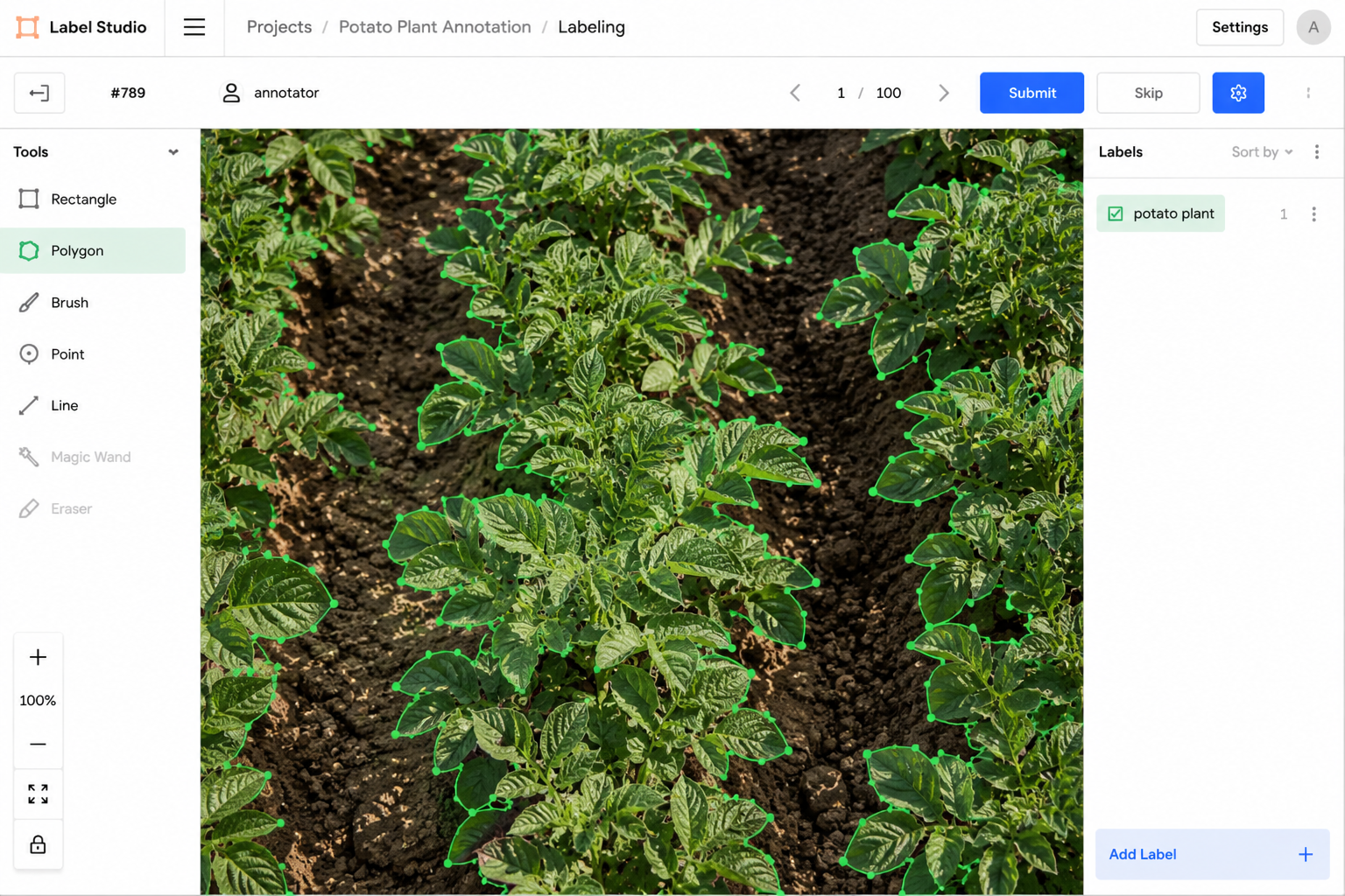
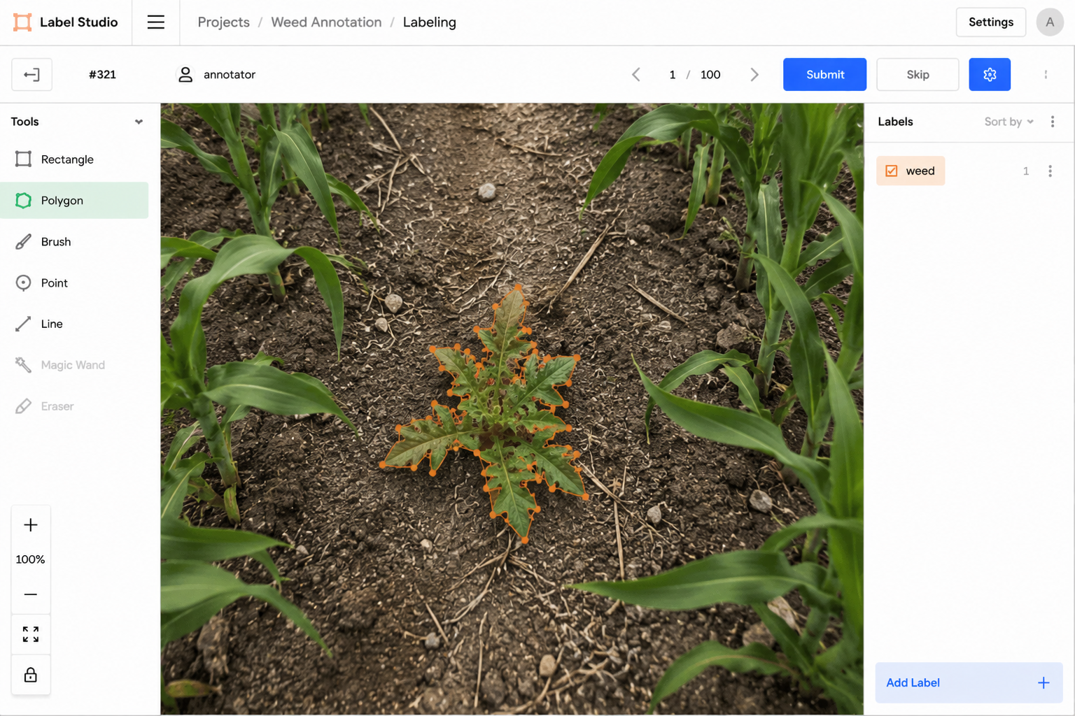
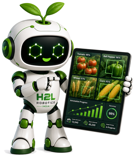
Our core annotation work covers tulips, potatoes, chicory, carrots, onions, and common agricultural weeds — all from real Dutch farm imagery captured by our parent company H2L Robotics BV. We annotate plants at all growth stages, including disease-affected specimens. We can onboard new crop types with a brief training pass on your specific imagery.
What annotation software do you use?
Our primary annotation environment is Label Studio, an open-source platform that produces clean, ML-ready export files. We use Python for data preprocessing, format conversion, and automated validation. PyTorch is used for empirical quality checks — we train lightweight models on annotated subsets to verify detection performance before delivery.
How do you ensure annotation quality?
Every batch goes through a multi-pass review process. Junior annotators complete the initial pass; a Senior Data Annotator then audits the output before any dataset ships. We track quality scores per annotator and per batch using a live Grafana dashboard. Our average QA review score across delivered batches is 0.97. For new project types, we run a calibration pass before full production to align on your annotation specification.
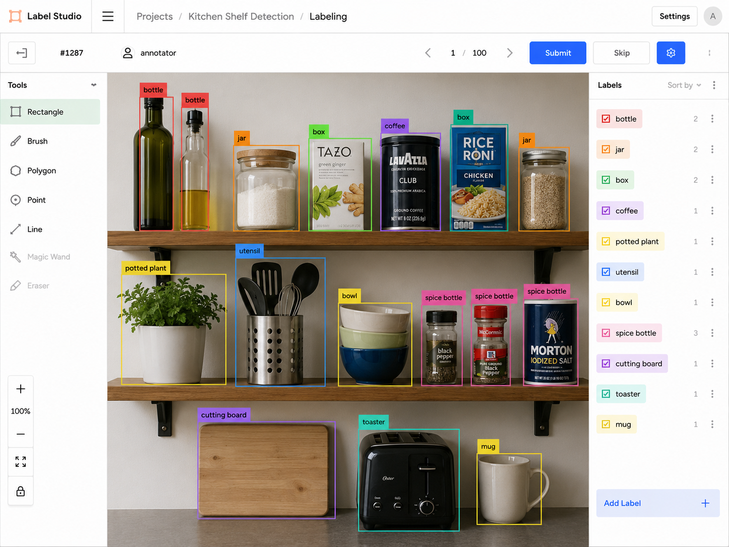
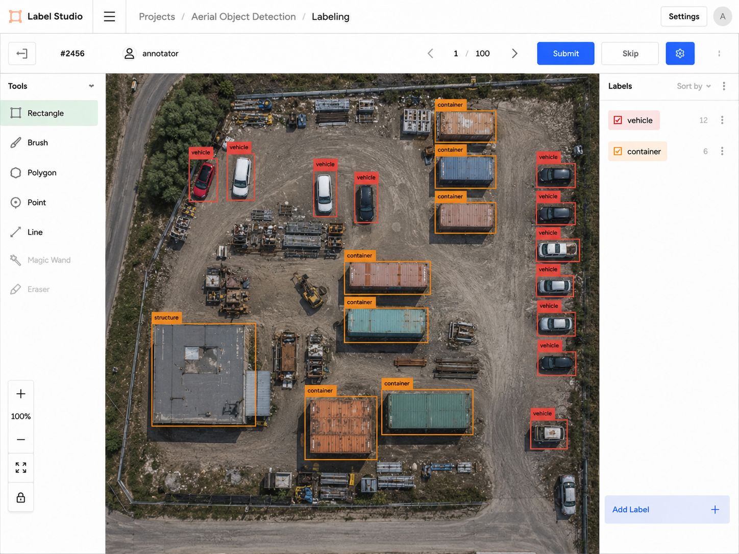
What is the difference between polygon annotation and bounding box annotation?
A bounding box draws a rectangular frame around an object — fast and sufficient when location and count matter most. A polygon traces the exact outline of the object with multiple points — slower but far more precise, capturing the actual shape and boundary. For plant disease detection and growth-stage classification, polygon annotation produces significantly more accurate training data because plant shapes are irregular and overlapping canopies make rectangles misleading.
What is the minimum project size you accept?
We work with projects of all sizes, from pilot datasets of 100–500 images to production batches of tens of thousands. For small pilots, we recommend starting with a calibration set of around 200–300 images so we can align on your annotation specification before scaling up.
Can you work with custom annotation guidelines and taxonomies?
Yes. We configure Label Studio to match your exact label taxonomy — class names, attribute schemas, overlap handling rules, and size thresholds. If you have an existing annotation guide, send it to us and we will train to it. If you are starting from scratch, we can draft a specification for your review based on your imagery and model requirements.
Where is H2L Robotics India based?
We are based in Vikhroli (East), Mumbai, Maharashtra, India — PIN 400083. We are a wholly-owned subsidiary of H2L Robotics BV, a Dutch agricultural robotics company founded in Delft, Netherlands in 2019. Our annotation team works on-site in Mumbai; our clients are primarily in Europe and North America. Reach us at info@h2lrobotics.in.